Courses
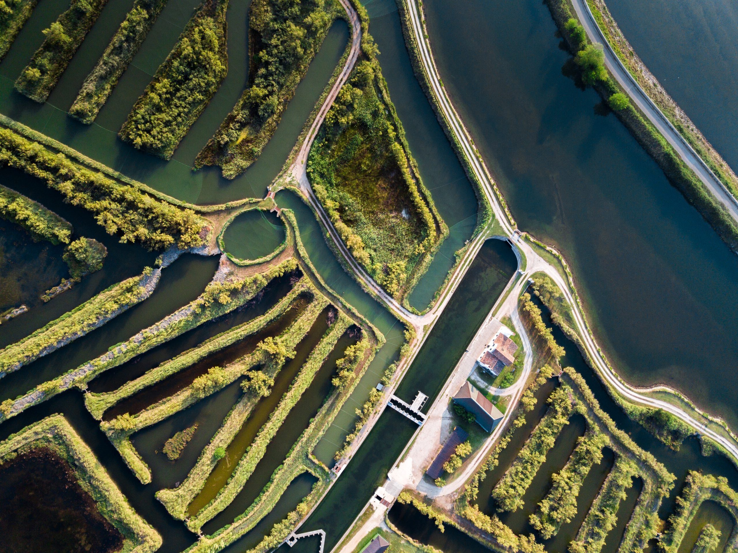
Groundwater and River Applied Modelling –
Module: Groundwater
Increasing anthropogenic pressure and climate change make the integrated management and protection of water resources increasingly indispensable. For this reason, professionals are needed who are able to understand both the dynamics of surface and groundwater as well as their interactions. The teaching follows a problem-based approach in which the solution of an environmental protection problem is achieved step by step, accompanying the student through the alternation between the explanation of theoretical concepts and their application during laboratory activities using software widely used in the professional field. The project, usually developed in groups, concerns a real case of risk of ground and surface water pollution due to uncontrolled storage of industrial waste. The fluid-dynamic processes of the groundwater surrounding the site and the adjacent watercourse are analysed, as well as the interactions between the two water bodies. The theoretical elements for understanding the processes are provided as a basis for the correct and conscious use of the calculation codes used in the project. Students analyse the system by coupling mathematical models of surface and subterranean flows on a suitable calculation domain; the analysis tool is then used for the feasibility study of environmental protection works (embankments, barrier wells, …). The design laboratory activity is representative of the integrated approaches required to tackle the complexity of civil and environmental engineering problems and the geosciences in general.
Analysis and interpretation of urban and rural soil and landscapes –
Module: Physical geography and geomorphology
The integrate course aims to give the basic knowledge and methods to read and assess, at different scales, the landscapes and interpret relationships between environment, geology and humans, in the present and the past. A special focus is given on landscapes and changes in landscapes from a historical, cultural and geological point of view. A key issue is how geology influences human activities and how human activities, cultures and society use and transform rocks/soil characteristics and related landscapes. The issue is developed by two modules, strictly related. The main topics of the Module 1 (Interpretation of urban and rural landscapes): landscape as product of the interaction between humans and environment; theoretical concepts, methodological process and tools to interpret and assess tangible and intangible physical characteristics and values of landscapes, using the main international references and tools; Landscape as resource and heritage: relationships between existing characteristics and planning, management and design strategies and actions. The main topics of the Module 2 (Physical Geography and Geomorphology) are: geological dynamics, geological structures and soils, geodiversivity, geology and landscape, landscape change, erosion and landslides